
Valley Parkway · Rocky River Reservation
Steelhead access map
Twelve miles of main stem, nearly all of it public. Park at the lots below and walk to the water. Listed downstream to upstream, mouth to Berea.
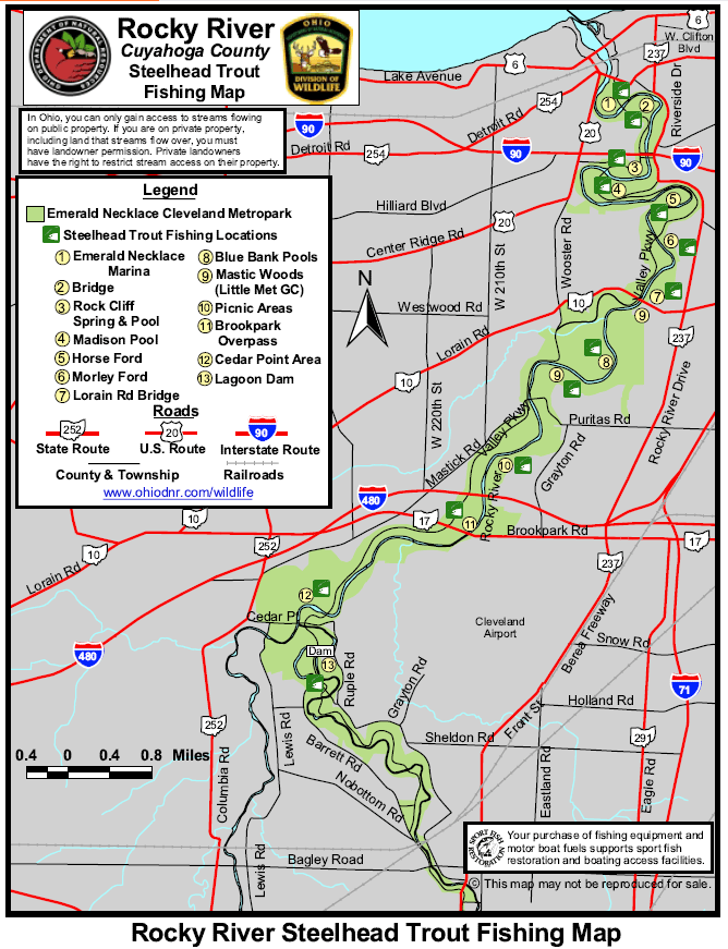
Access points
Where to park and what kind of water you will find. Send me your notes and I will correct the list.
Emerald Necklace Marina & the mouth
First water the fish see. Early-season staging in September and October, and drop-backs on the way out in spring.
Lake water · boat & shore
Scenic Park
Big, slow lower-river pools. The place to be when everything upstream is blown; clears a day ahead of the gorge.
Wide pools · easy wading
Lagoon & Rockcliff Springs
Gorge water. Shale ledges, drop-offs, and the classic holding lies the river is known for. The ford closes in high water.
Shale ledges · ford crossing
Morley Ford & Tyler Field
Long runs and riffles with plenty of room to spread out. Heavy pressure on weekends; go on a weekday morning.
Runs & riffles · crowded
Cedar Point Road & the confluence
Where the East and West Branches meet. Smaller water and fewer people, with fish moving through on every push.
Small water · quiet
Berea Falls & the East Branch
Upper limit of the run in high water. Steep banks and careful footing, but fish stack below the falls.
Upper limit · steep banks
High water closes things. Parking lots and the low-level fords shut during high flows, and a closed ford is the surest sign the river is unfishable. Check the Metroparks alerts page before you leave the house.
Want turn-by-turn directions to each lot?
DriftLogic puts these access points on a live map for 67 steelhead rivers, with one-tap directions and today's rig for the water you pick. $4.99 once, no subscription.